 |
| SOMBRERO PEAK AND TIBIG-BANOI RANGE AS VIEWED FROM KOGONAN RIDGE |
MT. TILOS: A PEEK TO THE UNSEEN PEAK OF MALABRIGO
POINT
Acknowledgement: I Ramon Q. Gayas Jr. would like to extend my gratitude to
all the people who helped us in making our climb possible especially to the
following persons: Professor Anacleto M. Caringal of Batangas State University,
Sir Nicasio Duenas Chairman of Brgy. Malabrigo Lobo, Batangas, and to our
guides Rolly Magtibay and Elmer Magtibay, I would also like to thank my team
who did the said climb: Drew Amon, Lhaine, Rolven Ciriaco, Monna Policarpio,
Jep Erenio, Atoz Monroyo, Jelson Tolentino and Randy Amos, as it would have
been close to impossible to have succeeded without their support.
OVERVIEW
A precious piece of nature concealed at the southwest
corridor of the stunning Lobo San Juan Mountain Range, is Mt. Tilos, which stands
near the seaside community of Brgy. Malabrigo in Lobo Batangas. The landscape use
by the lowland folks for grazing cattle and farming sugar apple and tamarinds -
by which this town of Lobo is famous - is also a great potential hiking
destination. Mt. Tilos is an impressive peak that is secluded and rarely
explored. It is just one of the many peaks continuums of Mt. Naguiling which provides
an excellent viewing opportunity and adventure for every trekker. Thrillingly,
this mountain also offers bouldering challenge downstream, and is near to other
tourist destinations such as beautiful beach resorts and historical lighthouse.
 |
| BSU' PHOTO: BRANCH OF DUNGON / MT. TILOS |
 |
| AT THE ROCKY CHANNEL |
 |
| VERDE ISLAND AND ILIJAN-LOBO COAST |
 |
| NALAYAG AS VIEWED ALONG THE TRAIL TO SUMMIT |
 |
| ZOOMED PHOTO: NALAYAG ROCKS |
 |
| AT THE ROCK BOULDER TRAIL |
Overall, Mt. Tilos is a noteworthy hiking spot, with
splendid views, distinct challenges, and sure access for side trip. Moreover,
the exploratory features and scenery of its neighboring peaks makes it a
compelling hiking destination - a highly recommendable day hike destination in
the tourist-oriented town of Lobo, Batangas. (See additional information, sample estimated budget computation and suggested itineraries below)
 |
| JUMP-OFF / PUROK MALVAR |
 |
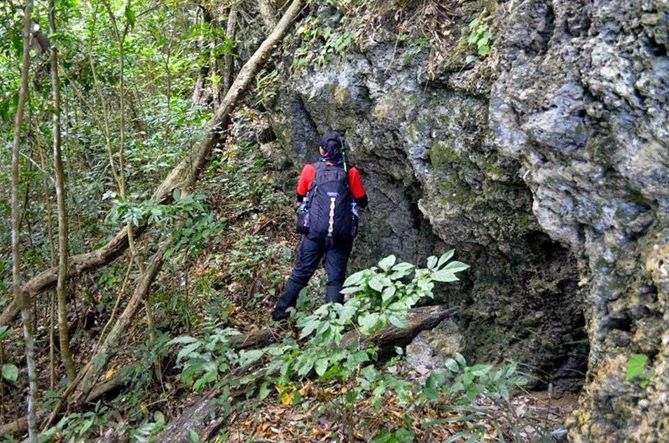
| ROCK FORMATION AT THE FOREST PRIOR KOGONAN RIDGE |
 |
| APPROACHING KOGONAN RIDGE |
.jpg) |
| AS VIEWED FROM KOGONAN RIDGE |
 |
| FEATURING THE SPATIAL RELATION OF NALAYAG (L) AND MT. TILOS (R) |
 |
| AERIAL PHOTO OF MALABRIGO POINT: SEASCAPE, LIGHT HOUSE AND MOUNTAINS PHOTO: PHILSCA, FERNANDO AIR BASE, LIPA CITY, 01-25-2013 |
 |
| PROF. ANACLETO M. CARINGAL (BSU RESEARCHER) AT NAGPATONG, NEIGHBOR PEAK OF MT. TILOS |
 |
| L-R: ROLLY MAGTIBAY (LOCAL GUIDE) CLAIR ANN ELMIDO AND ROMEL U. BRIONES (BSU RESEARCHERS) |
 |
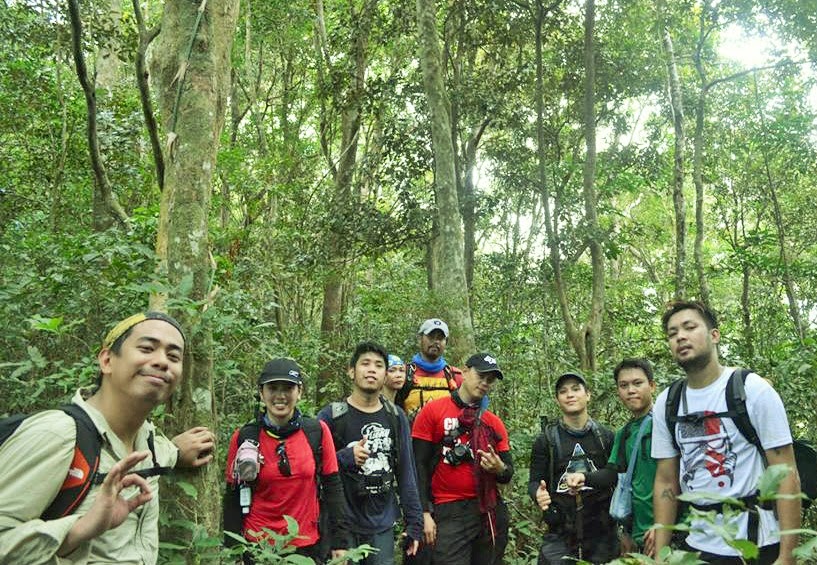
| THE BLOGGER's TEAM (L-R) DREW AMON, GHISLAINE BONGANAY, ROLVEN CIRIACO, MONNA POLICARPIO, JEP ERENIO, ATOZ MONROYO, JELSON TOLENTINO, SER MONTAINEER AND RANDY AMOS |
ADDITIONAL INFORMATION
Mountain’s Profile
|
Major jump-off: Purok Malvar, Brgy,
Malabrigo Lobo, Batangas
Elevation: (610+MASL) Kogonan Ridge, (640+masl
) Summit
Hours of Climbing: 5 to 6 hours
Days of Climbing: 1 Day
Alternate trail: Boulders Trail
Specs: Major Climb
Difficulty: 6/9
Trail classes: agricultural terrain, rocky
channel, woodland trail, forested trail, grassy trail, boulders trail
Features: tropical dry forest, scenic views,
coastal view, exploratory, bouldering
|
Transportation notes
(As of February 08, 2015)
|
For commuters: P157 - BUS - Manila to Batangas City
Grand Terminal
P20 per - JEEP - Batangas City to Lobo Jeep Terminal (2
rides)
P56 - JEEP – Lobo Terminal to Lobo Poblacion
P60
-TRICYCLE - Poblacion to Purok Malvar Malabrigo
Last trip:
Lobo Poblacion to Batangas City -1700 / Batangas City Grand Terminal to
Manila - 2030
24 Hours
bus terminal: Batangas Pier and Lipa
For
private transportation: Head out your trip to Batangas City Diversion Road
via SLEX Star toll-way, then take the road to Lobo, Batangas (left corner of
diversion). From Poblacion, proceed to Malabrigo coastal road and alight at
the waiting shed of Purok Malvar (before spillway). Ask the locals about parking
area. Approximately 3 to 3.5 hours travel time from Buendia, Taft Avenue.
For Jeepney rental: You may contact Tatay Obet Valencia
at 09398645306 (P1500 one way- from batangas city grand terminal to jump-off,
vice versa)
|
Registration / Coordination
|
Coordinate your hiking plan to Chairman
Nicasio Duenas
Register at PNP Lobo, no fees collected
|
Contact Persons / Numbers
|
Jump-off’s Chaiman - Nicasio Duenas 09174448011
For eco-tour in Lobo - Prof. Anacleto
Caringal of BSU 09369365887
Lobo Hotline - 09983144867
|
Guide and Guide fee
|
Note - Getting guide is highly recommended
(new hiking destination)
Local guide - Rolly Magtibay and Elmer
Magtibay - You may contact them through chairman Nicasio Duenas
Recommended fee for day hike - P500-P600
per guide
|
Water source
|
Available at the Jump-off, no water source
along the trail
|
Hiking notes and Precautions
|
Note - New Hiking destination
Prerequisite - 5 to 6 hours day hike and bouldering
experience is an advantage
Day hike - Highly recommended
Night trekking - Not recommended due to
unavailability of campsite
Bouldering - Recommended only for light
packed descent, not for ascent and night trekking. This is doable for manual
descent; however, using 10 to 15 meters rope might be helpful.
Cell phone signal - Present at the
jump-off, kogonan ridge and summit, sporadic at the boulders section
Amount of water to bring - 2.5 to 3L for
day hike
Sunlight exposure - At kogonan ridge down
to eastern grassy slope
River Crossing - Nothing major
Thorny Plants - Minimal
Bladed Grass - Minimal
Rope segment - None
Limatik - None
|
Camping notes
|
Mt. Tilos is not recommended for camping to
avoid wild life disturbance, there is no established camp site, and no water
source. However, you may camp in Malabrigo beach resorts if you wish to stay
overnight.
|
Side Trip and Facilities
|
Malabrigo Beach - Some spots there is
public and free for swimming, however,
ask the locals about resorts’ fees (entrance, cottage and camping) if you have
plan to stay overnight
Malabrigo Light House - Accessible by
tricycle as per local guide
Shower area - At local sari-sari store near
spill way, P20 per shower
Sari-sari store - Near spill way
|
Estimated Budget
|
P900 - See separate sample budget
computation below
|
SAMPLE ESTIMATED BUDGET COMPUTATION (for manila-base
hikers)
Number of participants
|
8 Persons
|
8 Persons
|
Duration
|
1 Day / Day Hike
|
1 Day / Day Hike
|
Transportation
|
Commute
P314 per person: BUS - Manila to Batangas City Grand
Terminal (back and forth
P40 per person: JEEP - Batangas City to Lobo Jeep
Terminal (back and forth)
P112 per person: JEEP – Lobo Terminal to Lobo Poblacion
(back and forth)
P60 per person: TRICYCLE - Poblacion to
Purok Malvar Malabrigo (back and forth)
|
Commuter with rented jeepney
P314 per person: BUS - Manila to Batangas City Grand
Terminal (back and forth)
P375 per person: Rented Jeep – Batangas
City Grand Terminal to Purok Malvar Malabrigo (back and forth)
|
Guide fee
|
P75 per person
|
P75 per person
|
Contingency fund
|
P299 per person
|
P136 per person
|
TOTAL
|
P900
|
P900
|
SUGGESTED ITINERARIES
Note: For option A, consider
jeepney rental or private vehicle due to impossibility to catch the last trip
in Poblacion. You may also modify the itinerary base on your group
preference.
OPTION A: DAYHIKE – Kogonan Ridge - Summit - Boulders
(Major Climb)
0300 Assembly at bus
station (Buendia, Taft Ave)
0330 ETD to Batangas
City Grand Terminal
0530 ETA Batangas City
Grand Terminal / Take rented jeep
0630 ETA PNP Lobo
Poblacion / Register / Breakfast / Proceed to Jump-off
0730 ETA Waiting shed of
Purok Malvar (near spillway) / Courtesy call to Chairman Duenas and Kuya Rolly
Magtibay (Guide)
0800 Start trek
1100 ETA Kogonan Ridge
(Mataas na Kogonan) / take picture / early lunch
1200 Resume Trek to
summit
1400 ETA Tilos (forested
summit) / take picture / proceed to boulders trail
1500 ETA “Kaumay” Boulders
Trail
1800 ETA Jump-off / Rest
and proceed to Malabrigo beach for night swimming (optional)
2000 Head back to
Batangas City via rented jeep (At Pier and Lipa, bus ride is 24 hours)
2100 Head back to Manila
2300 ETA
Manila
OPTION B: DAYHIKE - Kogonan Ridge - Back trail to
Jump-off (Minor Climb)
0300 Assembly at bus
station (Buendia, Taft Ave)
0330 ETD Batangas City
Grand Terminal
0530 ETA Batangas City
Grand Terminal / Take jeep to Lobo Jeepney Terminal (2 rides in the morning)
0600 From Lobo Jeepney
Terminal, take jeep to Lobo Poblacion
0700 ETA Lobo Poblacion
/ Register at PNP Station
0730 Take tricycle to
Jump-off
0800 ETA Waiting shed of
Purok Malvar (near spillway) / Courtesy call to Chairman Duenas and Kuya Rolly
Magtibay (Guide)
0830 Start trek
1130 ETA Kogonan Ridge
(Mataas na Kogonan) / take picture / Lunch
1300 Back trail to
Jump-off
1500 ETA Jump-off / Rest
/ Visit Malabrigo Beach or Light House (optional)
1600 Head back to
Poblacion
1630 Take last jeepney
trip going to Batangas City Grand Terminal
1730 ETA Batangas City
Grand Terminal / Head back to Manila
2000 ETA Manila
---SPECIAL THANKS TO PROF. ANACLETO M. CARINGAL, GHISLAINE BONGANAY, ROLVEN CIRIACO AND ATOZ MONROYO FOR THE PHOTOS!!!---
This was the placeI used to go together with my Father to gather cogon for our nipa hut.
ReplyDeletemy friend, you are living in the "satoyama" landscape where humans live harmoniously with forests, grassland and rivers
DeleteThank you sir!
ReplyDeleteIf via Boulders Trail difficulty should be 9/9....our team just made it yesterday.....it is a trail of prehistoric environment, you could see all kinds of trees to giant ones, passing by stones of all sizes....its a terrific hike adventure EXTREME!!!
ReplyDeletebring a sturdy rope for rappelling, headlamp if you'll stuck late in the trail...this trail is allowed only for well trained hikers/mountaineers....its a very dangerous trail, only for the fit ones are advise to venture this trail
ReplyDeletebring a sturdy rope for rappelling, headlamp if you'll stuck late in the trail...this trail is allowed only for well trained hikers/mountaineers....its a very dangerous trail, only for the fit ones are advise to venture this trail
ReplyDelete