Friday, October 27, 2017

SNEAK PEEK BEYOND THE REACH OF SIGHT - Part I: “Lake Viewing with Binoculars”

LAKE VIEWING WITH SOLOGNAC 8X42 500 SERIE BINOCULARS
SNEAK PEEK BEYOND THE REACH OF SIGHT - Part I: “Lake Viewing with Binoculars
By: Ramon Q. Gayas Jr. (Ser Montaineer)

SOLOGNAC 8X42 500 SERIE BINOCULARS WITH HARNESS
On my recent outdoor trip, I had an opportunity to try out some of my merchandise from Wild Discovery Department, Decathlon Philippines Inc. These are the Solognac 8x42 500 serie Binoculars and Binoculars Harness. It is a privilege given to us by the company, to use our product outside the store for testing purposes. I haven't tried bringing this kind of instrument in my several years of doing outdoor activities. However, I am aware about the enjoyment it brings, as I enjoyed using binocs when I participated in a guided birding trip at UP Diliman last month, where I learned the basic binoculars adjustment and ways of responsible bird watching. That's why I felt this first product testing as a great opportunity, gave additional excitement knowing I would do it for Lake viewing at the Lake City of San Pablo, Laguna, which I quickly planned with my PNU-colleagues Heide Banday and Erl Lim for my 35th Birthday.

On October 14, 2017 around 08:00 in the morning at the very familiar Jollibee branch in San Pablo, I found myself speaking with tricycle driver named Pablo Lauigan, arranging trike service in order to visit the available eco-tourists Lake in the vicinity. Though a bit pricey which costs P700, I grabbed his offer considering that we're still affected by the bad weather made by typhoon Odette and to look for other driver might be time consuming.

GLOOMY MORNING AT LAKE SAMPALOC
Our trike ride started at 0830 AM and we fastly arrived at our first target, in Lake Sampaloc. Unfortunately, it was very gloomy and rainy that time, I am unable to use the binoculars during the time we are in Sampaloc. However, I found the place nice for tree walk and birding activity. I saw some birds - mostly Eurasian tree sparrow and Shrikes - and some common Philippine Native Trees like Narra (pterocarpus indicus) Talisay (terminalia catappa) and Acacia confusa. Interestingly, the 4 KM road encompassing the biggest Lake of San Pablo is apparently potential for running and walking, as one of my companion - Erl - had tried surveying it before. Then, by the time we are preparing to leave Sampaloc, the rain has slowly stop. So I took this moment to prepare the harness and binocs for our next viewing.

Continuing on to the next lake, we had reached Lake Mohicap at around 0945 AM. After paying the registration fee (P10), we directly proceed to the marker for photo opt and descended the 105 steps downstream. Upon reaching the lake's shore, the caretaker warmly welcomed us and gave some information about the place.

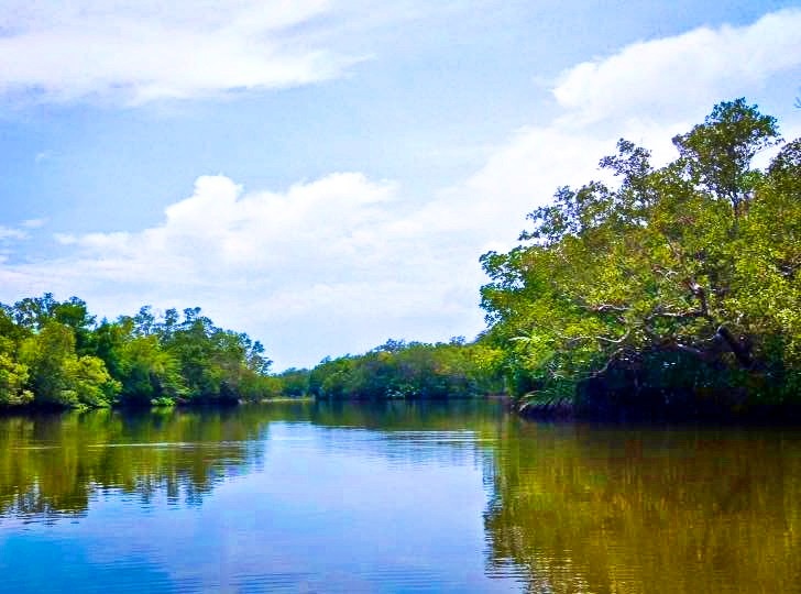
THE LAKE MOHICAP AND IMOC HILLS
Thereafter, we started to indulge the surroundings. The place looks refreshing, showcases greeneries and impressive view of notable landscape known as Imoc Hill. On the other hand, by the time I started using the Solognac Binoculars there, I enjoyed seeing the vegetation literally magnified, even the occasional raindrops, as if I'm closed to the features I am looking at. I can also easily adjust the binocs to clearly see every object I am spotting. While the Solognac Binoculars Harness is elastic, very manageable to use combined with the binocs. It makes me roamed freely, enables me to descend the shore, go up and down and go over the bamboo raft to get spotting position without requiring my hands to hold the optics. The harness securely compressed and hanged it on my chest. Furthermore, through using the Solognac Binoculars I was luckily spotted one of the bird species in the Lake, the Barn Swallow (hirundo rustica) locally known as "Layang layang", flying above us, chirping, playing and landed several times near to our standpoint.

AT THE MARKER
DESCENDING THE 105 STEPS
It was past 10:00 AM when we left Lake Mohicap, aiming to visit the other lake next to it, the Lake Palakpakin. Short trike ride after, the driver dropped us at one small bridge. At this point, Mang Pablo told us that bridge is the only way to see the Lake Palakpakin. Since, there is no other access to get closer we only took short sightseeing then headed to Lake Pandin. Even though we are notified by the caretaker in Mohicap that Pandin is close to visitors due to right of way issue.

THE RANCH AND VIEW OF MT. BANAHAW-CRISTOBAL
On the way to Lake Pandin, our venture commence at one community. One young boy - I named "Utoy" - approached us and offers a guide service, gave guarantee that there is a newly opened trail to reach Pandin. But I respectfully refused, hoping I could still track the landmark I've passed through when I visited the place as side trip of my Mt. Mabilog climb way back year 2011. However, many changes happened in the past six years. Infact, I got confused during the trek, but thankful that Utoy still following us when I did back trail. Then, I accepted his offer to guide us. Our trek resume at the ranch that is temporarily opened for Pandin visitors. This place is surprisingly beautiful; gave us way to see some cows roaming at the green grassy slopes, glimpse the views of Mt. Banahaw-Cristobal complex as well as Mt. Malarayat range. Though slightly rainy, muddy and slippery, we managed the trek to Lake Pandin within 20 minutes. Longer than the usual trekking time from the old trail, yet definitely more scenic.

AT LAKE PANDIN
At the Lake Pandin, we've been closer to the lake through our rented bamboo raft. The "bankeros" brought us to the opposite shore then we ate the food they served such as; grilled tilapia, okoy na hipon and fern ensalada. There, we are treated to witnessed the emerald green water section of the lake, we saw many small fishes they dubbed as "ayungin", joyfully tried the man-made swing, took photos, behold the refreshing air and the beautiful surroundings. I also had fun to spot the things behind us using the Solognac Binoculars. I saw some butterflies mostly white and yellow, birds like Grey Heron (ardea cinerea) and group of White Herons (ardea alba) flock over the lake. There is also one interesting bird we can't identify. This is different from the mentioned birds as its bearing short tail and white feathers with black spots. Yet showing capabilities same as the other migratory birds, that is impressively flying, wading and eat fishes.

Visiting Pandin is our main plan and we're glad to make it despite of weather disturbance. Though, we're not able to conquer the other Lakes (Yambo, Bunot and Calibato), Pandin experience rewarded us an exciting finale. Bringing all the good vibes and learnings from the lake viewing we had, we decided to leave the place by 3pm, and safely headed back to Manila.

Overall, bringing binoculars in my outdoor trip gave additional weight on my backpack. It cannot record the moment and sceneries we had at the Lake we've visited unlike the camera. Yet it has no charging requirement and I enjoyed using it to the fullest. Moreover, it gives considerable importance to me in seeing features from outdoor beyond the reach of my normal sight. I will surely not hesitate to use the Solognac Binoculars again and explore its diverse function in enjoying the great outdoors. Looking forward for Part II.

AT THE  FLOATING COTTAGE IN LAKE PANDIN
ENJOYING MAN-MADE SWING IN LAKE PANDIN
OUR FOOD IN LAKE PANDIN


Sunday, May 14, 2017

MANGROVE FOREST OF LOBO: "Wondering Walk through the Boardwalk of Lagadlarin"

THE BOARDWALK OF LAGADLARIN'S MANGROVE FOREST
MANGROVE FOREST OF LOBO
"Wondering Walk through the Boardwalk of Lagadlarin"
By: Ramon Q. Gayas Jr. (Ser Montaineer)

NOTE FROM THE BLOGGER: As we presently celebrates the Month of the Ocean, I dedicate this write up for wildlife's habitat that is very relevant to the sea, the Mangrove Forest. I wholeheartedly support that responsible use of mangrove forest in ecotourism is a great way to appreciate, nurture and preserve our beach forest, towards protecting the coastline and marine biodiversity, and strengthening our resilience to climate change.

OVERVIEW                                        

MANGROVE SWAMP
One cool stuff from the variety of adventures can be done once you set foot in the town of Lobo, Batangas is the trek through the “Boardwalk” of Brgy. Lagadlarin's Mangrove Forest. Formerly threatened with devastation, but folks are now eager to preserve this valuable wildlife's habitat as an Ecotourism site. A must visit attraction in Lobo which offers pleasant and enjoyable scenery. Just 20 minutes ride from the town proper and an easy 45 minutes to 1 hour boardwalk trekking, visitor enables for close-up mangrove forest experience.

TAKEN FROM OPEN TREE HOUSE
The trek through the boardwalk initially passing some Mangrove Palm trees (nipa fruticans), which eventually heading deeper to a wide bunch of Mangrove trees. You can glimpse to the "Mangrove Swamp" while passing - much closer from the bamboo bridge placed across - and might think for short, yet very potential "paddleboat tour". While climbing the man-made open "tree house" may give refreshment and makes you feels the ambiance atop the mangrove forest. Don't worry for the weariness, as there are established rest stop point in the area and a lot of photogenic spots ahead where you can stop by. More importantly, enjoy the surreal feelings from nature's sounds and being with it. All these are good for daylight tour and could be an extension of longer Lobo Batangas trip. Highly recommended!

ONE OF THE SEVERAL REST STOP POINT
OVERLAPPING BRANCHES OF MANGROVE TREE
PHOTO OPP SPOT AT THE END OF BOARDWALK
GROUP PICTURE ATOP THE OPEN TREE HOUSE COURTESY OF MS. RHONA
ADDITIONAL INFORMATION

Destination’s Profile
Major Jump-off: Brgy. Lagadlarin, Lobo, Batangas
Possible Duration: 1 to 2 hours Daylight tour
Features: Mangrove Forest, Swamp, Man-made Boardwalk, Open Tree House
Possible Activities: Boardwalk Trekking, Photo Opp, Potential for Paddleboat tour and Wildlife observation
Transportation
(As of May 06, 2017)
For commuters:

P157 - BUS - Manila to Batangas Grand Terminal Terminal (BCGT)
P20 – 2 JEEP - BCGT to Lobo Jeepney Terminal
P55 – JEEP – Lobo Jeepney Terminal to Lobo Poblacion
P60 – TRICYCLE – Poblacion to Lagadlarins Mangrove Forest

Last trip of Jeep from Lobo: 1700
Last trip of Bus from BCGT: 2000
                
For private transportation: Head out your trip to Batangas City Diversion Road via SLEX Star toll-way, take the road heading to Lobo Batangas. Afterwards, detour the ride to Brgy. Lagadlarin. Ask the local folk about parking area. Approximately 3.5 hours travel time from Buendia, Taft Avenue.

For tricycle and jeepney service from Lobo, Poblacion to Brgy. Lagadlarin: You may contact Romel Casilihan at 09077722052
Contacts and Coordination
Lobo Tourism Office: 09954960103
For Eco-tour you may contact Prof. Caringal at 09369365887
Registration and fees
Register at Pasalubong Center Lobo Poblacion and pay P20 Environmental users fee
Guide fee / Guide assistance
Not required

Water source
Available at the Jump-off community
Trekking notes and Precautions
Trend status – Presently gaining popularity, as of May 06, 2017

Prerequisite – Having knowledge about Mangrove ecosystem is an advantage

Daylight tour – Recommended

Night trekking – N/A

Cell phone signal – Sporadic in the entire boardwalk

Amount of water to bring – 1L for daylight tour

Sun exposure – In the afternoon, adjust your Itinerary

Wildlife encounter – Mostly birds and swamps’ small fishes
Campsite / Camping notes
N/A
Side Trip and Facilities
Beach at Lagadlarin

Shower area – At the Jump-off community

Sari-sari store  – At the Jump-off community
Estimated Budget
P600 (mangrove forest daylight tour for commuter)

SAMPLE ESTIMATED BUDGET COMPUTATION

(Mangrove Forest daylight tour for commuters from Manila, Make adjustment depends on your preference)

Number of participants
4 persons
Duration
Daylight tour
Transportation
P314 - BUS - Manila to Batangas City Grand Terminal (back and forth)

P150 – 3 JEEPNEY RIDES – Batangas City Grand Terminal to Lobo Poblacion (back and forth)

P30 per person – Tricycle service from Lobo, Poblacion to Brgy. Lagadlarin (back and forth)

Guide fee
N/A
Registration fee
P20
TOTAL
P600 (w/ P106 contingency fund)

SAMPLE ITINERARY

(Mangrove Forest daylight tour for commuters from Manila. Make adjustment depends on your preference)

0400 ETD Buendia Taft to Batangas City Grand Terminal
0530 ETA Batangas City Grand Terminal
0600 Take jeepney to Don Ramos
0615 ETA Don Ramos, take jeepney to Lobo Jeep Terminal
0630 ETA Lobo Jeep Terminal, take jeepney to Lobo Poblacion
0730 ETA Lobo Poblacion, Register at Pasalubong center, Breakfast
0800 Take tricycle to Lagadlarin Mangrove Forest
0820 ETA Lagadlarin Mangrove Forest, explore and take photo
1000 Optional side trip to Lagadlarin Beach, then headback to manila


Wednesday, February 22, 2017

MT. DARAITAN AND TINIPAK: "The Limestone and Stream Paradise in the Great Sierra Madre"

THE VIEW OF TINIPAK RIVER, MT DARAITAN ON THE BACKGROUND

MT. DARAITAN AND TINIPAK
"The Limestone and Stream Paradise in the Great Sierra Madre"
By: Ramon Q. Gayas Jr. (Ser Montaineer)

ONE OF THE SUMMIT'S LIMESTONE VIEWPOINT
The wondrous gems at the heart of the great Sierra Madre, concealed by the mountainous border of Gen. Nakar Quezon Province and Tanay Rizal, are "Mt. Daraitan" and "Tinipak". A set of fabled getaway destinations for outdoor lovers and ideal sites to those seeking for combined challenge of hiking, caving and streams escapade. Who would have thought that the places suffered from environmental neglect, threatened with deforestation and massive tourism are still able to preserve their serene beauties. Surprisingly, the reward of reaching these places is like having nuances of hidden paradise. But for those who had come unprepared, the hike through steep terrain up to the 739+masl summit of Mt. Daraitan and the descent via traversing trail could feel unforgiving. Interestingly enough, as one reach the summit one forgets the weariness as the climate becomes noticeably refreshing. While the presence of numerous quaint limestone viewpoints and dramatic features of Sierra Madre seen from the top gives feeling of exhilaration. Most of all, the river which bear crystal clear water, the unique subterranean cave, and the marvelous surroundings waiting at "Tinipak" may remunerate all the strenuous efforts of everyone surveying the area. All these combined makes a very fruitful nature tripping experience.

INSIDE THE SMALL CAVE ALONG THE TRAIL TO SUMMIT
AT THE SUMMIT OF MT. DARAITAN 739+MASL
AT THE OTHER VIEWPOINT IN MT. DARAITAN
AT THE WOODEN BRIDGE TO TINIPAK CAVE
ENTERING TINIPAK CAVE
AT THE STALACTITE SECTION OF TINIPAK CAVE
THE PANORAMIC TINIPAK RIVER AND IT'S GIGANTIC LIMESTONE FORMATION
ADDITIONAL INFORMATION

Destination’s Profile
Major Jump-off: Brgy. Daraitan, Tanay Rizal
Elevation: 739+masl (Unverified)
Hours of Climbing: 3-4 hours
Days of Climbing: 1 or 2 days
Alternate trail: Sitio Cablao, Gen. Nakar Quezon
Specs: Minor Climb
Difficulty: 4/9
Trail classes: Cemented road, woodland, forested trail
Features: Scenic view of Sierra Madre, Limestone viewpoints, Cave and pristine river
Transportation
(As of February 16, 2017)
For commuters:

P70 - VAN – Shaw Blvrd to Tanay Market

First Trip of Van from Shaw: 0400
Last trip of Van from Tanay: 2100
                
For private transportation: Head out the trip to Marcos Highway and go through the way passing Tanay-Infanta Road. Afterwards, detour the ride to the rough road heading to Brgy. Daraitan. Park prior the river, or near Brgy. Hall if wooden bridge is available to cross with vehicle. Approximately 2 to 2.5 hours travel time.

For tricycle and jeepney service from Tanay to Daraitan: You may contact Jhun at 09067856489
Contacts and Coordination
Head Guide Willy – 09069533470

Tanay Tourism Office - 09989881590
Registration
Register at Brgy. Hall and pay P50 environmental fee. Expect another P25 fees in Tinipak area for Dispute territorial payment and wooden bridge maintenance
Guide fee / Guide assistance
Getting guide is required (1 guide/5persons)
P500 per guide recommended for day hike
P750 per guide recommended for overnight

Local Mountain Guide:

Tour guide Jerson - 09261936116

Water source
Available at the Jump-off area and Tinipak
Hiking notes and Precautions
Hiking trend status – Popular hiking destination receiving daily arrivals

Reservation and Limit - No reservation, limited for 100 climbers only on week end as per the local official (as of February 16, 2017), avoid mass climbing though

Prerequisite – 4 hours day hike experience is an advantage

Day hike – Highly recommended

Night trekking – Coordinate night trek plan before proceeding

Cell phone signal – Present at the jump-off, sporadic throughout the trail and Tinipak

Amount of water to bring – 2 to 3L for day hike, 4-5L for overnight

Sun exposure – At the community road

River Crossing – Weather dependent

Terrain condition – The entire trail is established, gradual to steep and slippery when wet.

Thorny Plants – Minimal

Bladed Grass – Minimal

Lipa - Minimal

Rope segment – None

Limatik – None
Campsite / Camping notes
At Station 3, may accommodate 3-5 tents. Coordinate your camping plan before proceeding and bring enough water (4-5L).
Side Trip and Facilities
Tinipak’ cave and river

Shower area – At the Jump-off

Sari-sari store  – At the Jump-off
Estimated Budget
P1000s


SAMPLE ESTIMATED BUDGET COMPUTATION

(For manila-based commuters)

Number of participants
4 persons
Duration
Day tour
Transportation
P140 - VAN – Shaw Blvrd to Tanay Market (back and forth)

P250 – Tricycle service from Tanay Market to Daraitan (back and forth)

P30 – Tricycle from Daraitan river to Brgy. Hall (back and forth)

Guide fee
P125 per person
Registration fee
P75 per person
TOTAL
P1000 (w/ P380 contingency fund)

SAMPLE ITINERARY

0400 Assembly at McDonalds Shaw Blvrd (Edsa Central), near MRT Shaw Blvrd
0430 ETD to Tanay Rizal Public Market
0600 ETA Tanay Rizal Public Market, buy supplies, arrange trike service
0630 ETD to Brgy. Daraitan
0715 ETA Daraitan River, (cross with raft or via wooden bridge if available), trike ride to Brgy. Daraitan
0730 ETA Brgy. Daraitan, Register, Arrange guide assistance
0800 Start trek to Mt. Daraitan
1130 ETA Summit, Explore and Photo opt, Rest and Lunch
1300 Start descent to Tinipak
1500 ETA Tinipak, Explore cave and swim
1630 Head back to Brgy. Daraitan via riverbank
1700 ETA Brgy. Daraitan, Rest and wash, Log out
1800 Head back to Tanay, onwards to Shaw Blvrd.
2100 ETA Shaw Blvrd, Chillax (optional)
2300 Home sweet home